 BGS Data Catalogue
University of Eldoret
Type of resources
Topics
Keywords
Contact for the resource
Provided by
Years
Formats
Representation types
Update frequencies
-
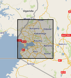
Soil prediction maps for 56 chemical elements, pH and organic matter content have been produced using machine learning analysis in western Kenya. The predictive maps were based on 452 soil samples collected across western Kenya during field surveys carried out between 2015 and 2020. Samples were analysed by the inorganic chemistry laboratories at the British Geological Survey. The maps, created using random forest machine learning algorithms, are displayed as raster files with a spatial resolution of 500m. The samples were collected as part of a geochemistry and health project to investigate the spatial incidences of diseases in the Rift Valley (e.g. oesophageal cancer, iodine/zinc deficiency), which included a range of data and sample collections to inform sources of micronutrients or exposure to potentially harmful elements, with outputs to inform agriculture and public health practitioners. These predictive maps provide a baseline geochemistry survey for the agri-community, academics and public health officials.